
The app that knows your boat.
BlueHelm is a boating safety and navigation app: chart-smart trip routing, an anchor drift alarm that works with the screen off, live float-plan tracking, marine weather and tides, and an onboard AI that answers questions about your specific vessel. Built by CKS, owned by CKS, live on the App Store and Google Play.
Built on Neural Ops. Our agent platform plans, builds, reviews, and ships it, with senior engineers owning every call that matters.
 live
live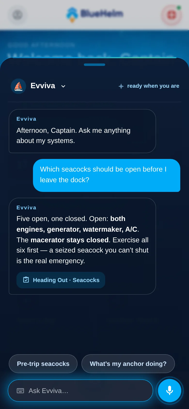
At a glance
- Type
- Our own product
- Platform
- iOS · Android
- Status
- Live on the App Store and Google Play
- Market
- US waters, coast to coast
- Built with
- Neural Ops
What it does
- Water-only route planning
- Background anchor watch
- Float plans + live tracking
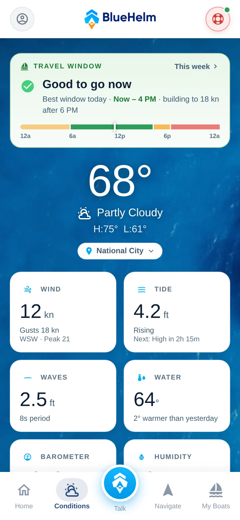
- Marine weather & tides
- Man overboard / SOS
- Per-vessel AI guide
- Offline marine gazetteer
- Subscriptions & entitlements
Overview
Boating runs on a patchwork: an aging chartplotter at the helm, a weather app on the phone, a paper float plan nobody filed, and the owner's manual for a boat you bought used and never got. The moments that matter most are the moments that patchwork fails: dragging anchor at 2am, reading the week's forecast before a crossing, someone going over the side.
BlueHelm puts the whole day on the water into one app. Plan the trip, watch the weather, run the route, swing safe at anchor, get home, with your boat's own knowledge a tap away. It is a planning and awareness tool, deliberately not a replacement for seamanship, official charts, or a VHF radio, and the app says so plainly.
Routes that follow the real water
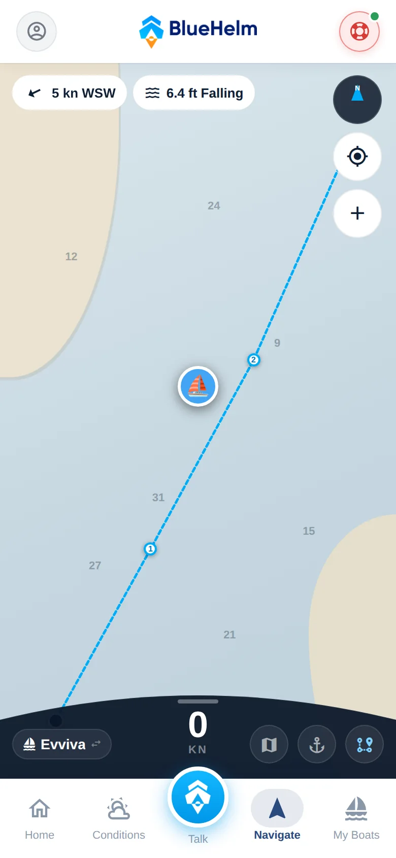
Most consumer apps draw a straight line between two points. On the water that line goes over a sandbar, through a breakwater, and across a headland. BlueHelm computes the course a boater would actually run, over real NOAA depth and channel data, threading the channels, clearing the breakwater, rounding the headlands, coast to coast across US waters.
Long-press the chart mid-trip and the route bends through the new stop in sailing order. Buoys and markers render on the chart, the route line follows the bow live, and wind is projected along the course hour by hour so you can see what you're driving into before you leave the slip.
An anchor watch you can sleep through
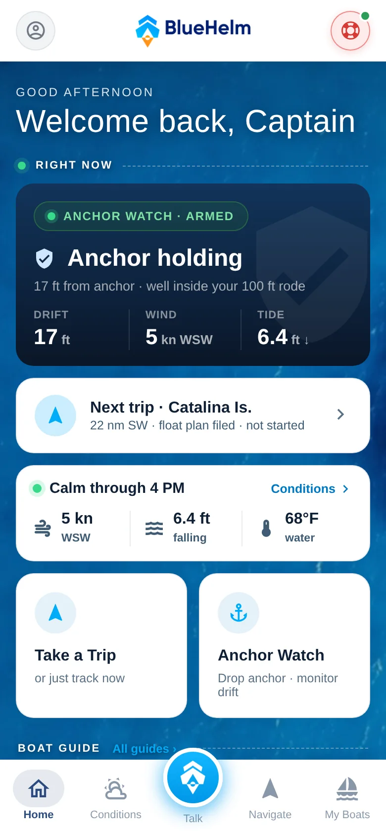
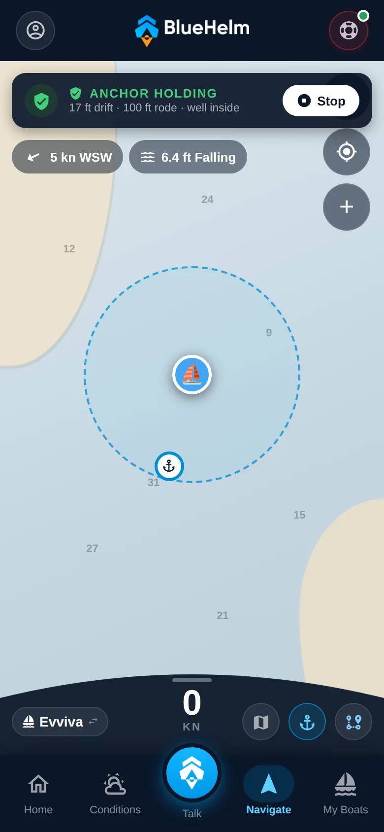
Drop the anchor, set the rode, and the swing ring draws itself on the chart. Drift outside it and the alarm fires with the screen off, on background GPS. That is the only version of this feature worth anything at 2am.
It arms mid-trip too: pull into a cove for lunch, anchor, and the trip keeps running. Live drift, wind, and tide sit on the same screen, so when the boat moves you know why it moved.
Float plans, and the people ashore
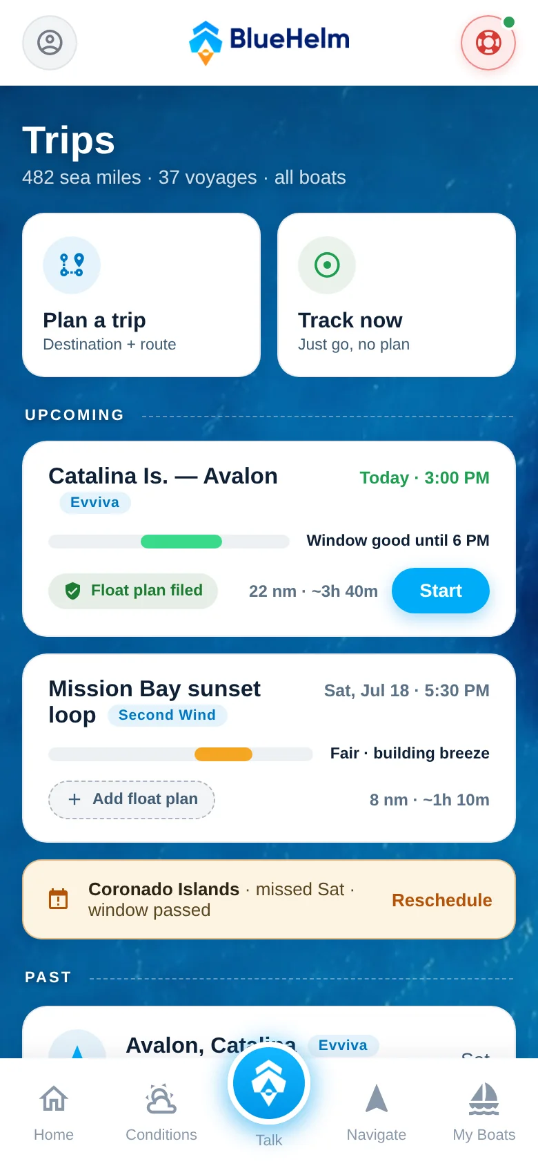
A float plan is the oldest safety practice in boating and almost nobody files one, because filing one has always meant a phone call or a piece of paper. BlueHelm files it in one tap: your boat, your route, and your timing go to your emergency contacts by email or text.
They get a private live link showing your intended course against your actual track. No app to install on their end. Every voyage is saved afterward with distance, time, and the track on the chart, across every boat you run. Search covers more than 16,000 marinas, harbors, and anchorages, and it works offline.
The boat's own AI
This is the part that is genuinely hard, and the reason it is interesting. Answer a series of questions about your vessel and the AI writes that boat's operating guide from your answers rather than from the internet's average boat. Then you talk to your boat by name.
“Which seacocks should be open before I leave the dock?” is answered from your boat's actual systems, not from the internet's average boat. Scenario flows for getting aboard, heading out, heading back and leaving the boat run as step-by-step checklists, from a standard template rather than from your answers. Emergency procedures are cached offline, because taking-on-water steps need to be on the phone before the moment you need them, not behind a cell signal.
The honesty constraint is the engineering. The model is grounded to the owner's own answers and instructed to say it doesn't know rather than fill a gap. Because no grounding is perfect, the app also tells the user plainly that AI answers can be wrong and that anything safety-critical must be verified. On a boat that disclosure is part of the product, not fine print.
How it was built
BlueHelm is the clearest demonstration of the Neural Ops method, because it was built almost entirely through it. Agents plan the work, write the code, run the regression suite against every user journey, take the screenshots, cut the builds, and push to the stores, with senior engineers reviewing and owning the calls that matter.
The cadence is the point, and so is what it does not skip. An automated suite exercises every user journey in the app on every build, independent adversarial review runs on the work before a human sees it, and a senior engineer signs off before anything goes to a store. Because that loop is automated rather than scheduled, a design change can be specified, built, regression-tested, and submitted in a day, with more validation than a manual process of the same length would get rather than less.
Travel window
Float plans
Routes
Anchor watch
Stack
Tell us the problem.
If your project doesn't look like anything on this page, that's the call. Tell us the problem and we'll tell you what's worth building, and what isn't.